Technology
One engine, from a country to a ranked target.
Five capabilities answer the questions that stand between the record and a piece of ground worth holding. We use the engine first on our own ground.
- 01 MineDSS Atlas What is actually known about this ground?
- 02 Open Ground Where can I still get ground, and which of it is worth having?
- 03 Prospectivity Targeting Where is this mineral most likely, and why?
- 04 Spectral Remote Sensing What is at surface, and what structures control it?
- 05 Due Diligence & Market Analysis Can I acquire it, hold it, and what will it cost me?























Data published by 80 organisations ·Names and logos belong to their owners; no endorsement or partnership is implied. All 80 sources
Capability 01
MineDSS Atlas
What is actually known about this ground?
Everything published about a country's geology, deposits and tenure, on one map, with the source of every layer.
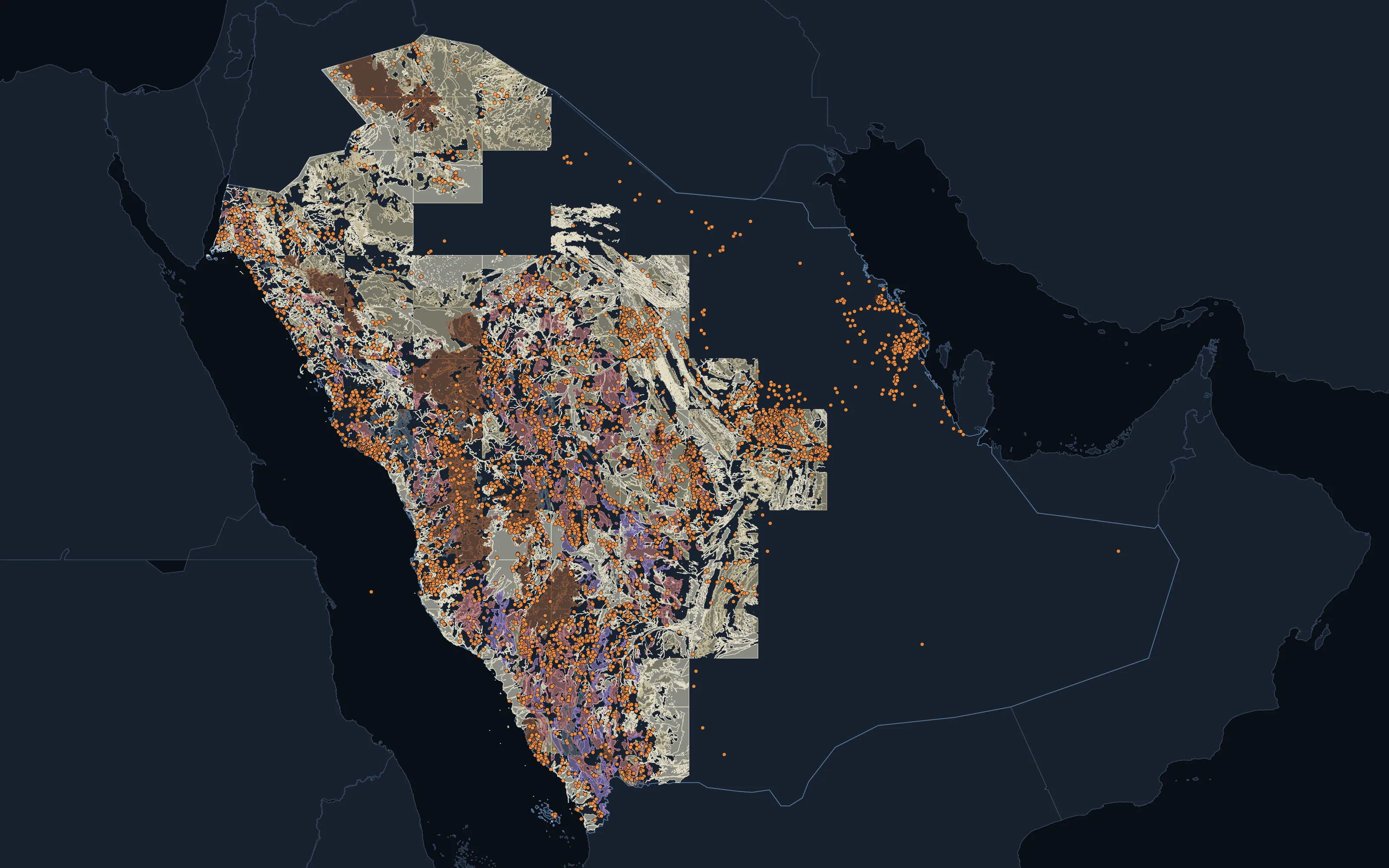
Saudi Arabia: national geology with mapped deposits and occurrences, as published by the Saudi Geological Survey.
Capability 02
Open Ground
Where can I still get ground, and which of it is worth having?
Which ground is open, held or excluded, read from each authority's own register, with open blocks ranked by the deposit record.
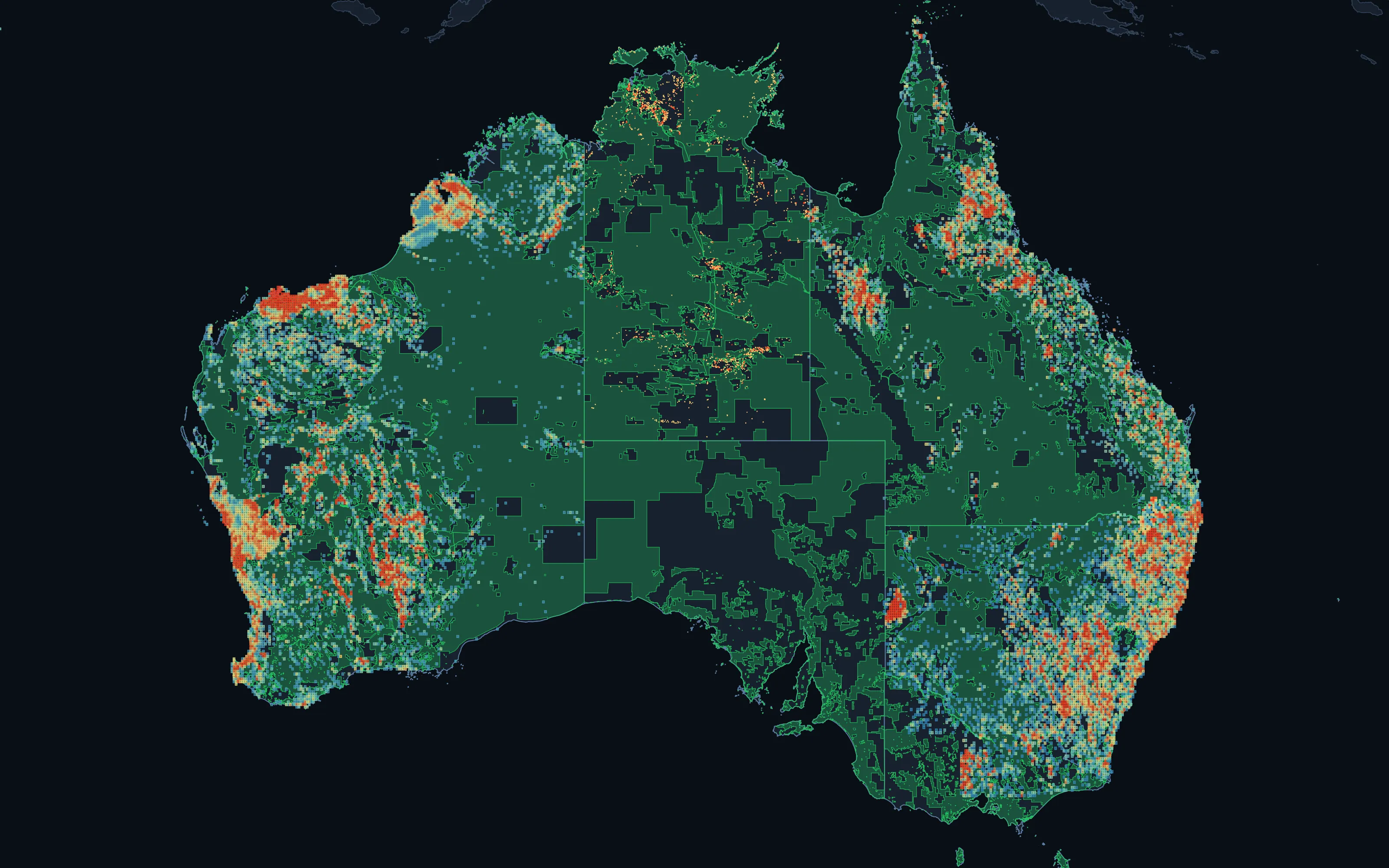
Australia: open ground in green, with open pegging blocks ranked by recorded mineral endowment from low (blue) to high (red). An endowment screen of the recorded deposit record, not modelled prospectivity.
Capability 03
Prospectivity Targeting
Where is this mineral most likely, and why?
Machine-learning models score the ground for each mineral and show the evidence behind every target; project and 3D models follow as field data and drilling come in.
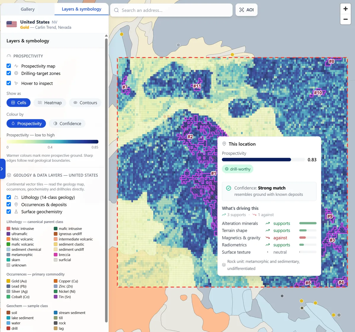
Carlin Trend, Nevada: gold prospectivity with ranked targets and the evidence behind a selected location.
Capability 04
Spectral Remote Sensing
What is at surface, and what structures control it?
Satellite mapping of the alteration at surface and the structures that control it, from regional scale to camp scale with WorldView-3.
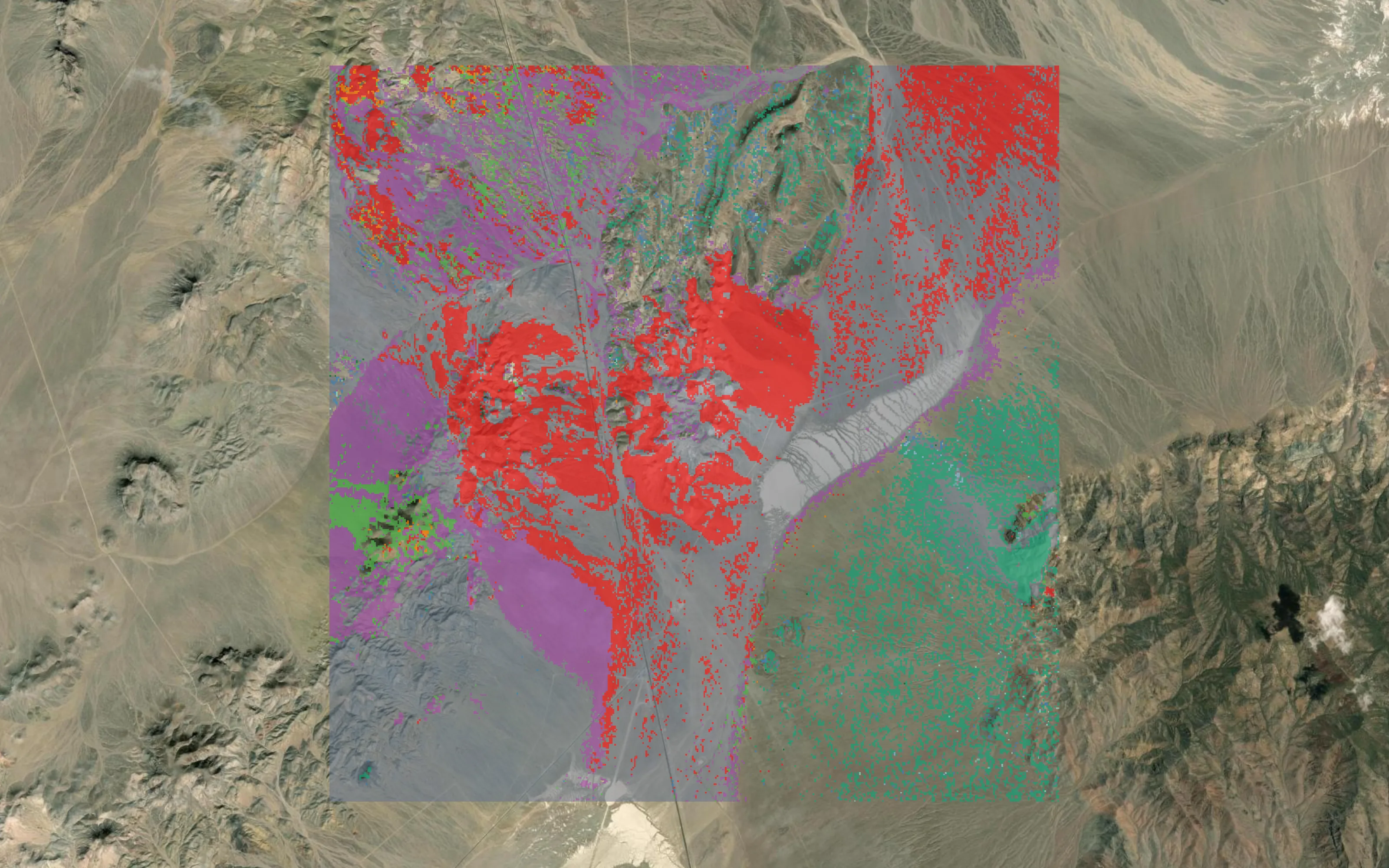
Cuprite, Nevada: alteration mineralogy from a 30 m EnMAP hyperspectral acquisition, matched against laboratory reference spectra. Cuprite is the published USGS reference site we benchmark against.
Capability 05
Due Diligence & Market Analysis
Can I acquire it, hold it, and what will it cost me?
Tenure, land access, environment, and the cost to hold and drill, checked before capital is committed.
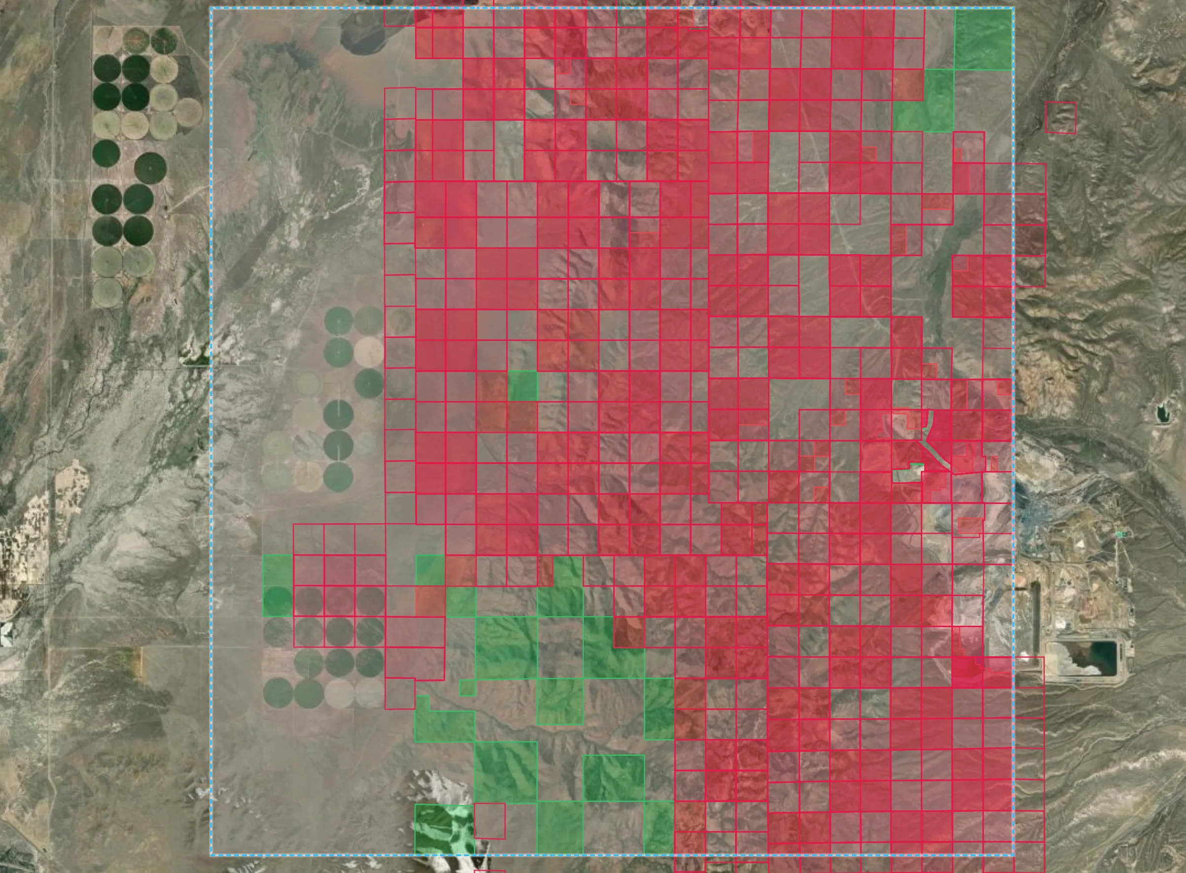
Carlin Trend, Nevada: federal land classified from the live claim register, with active mining claims in red against open federal ground in green, and an operating mine at the eastern edge.
Partner
Spectral remote sensing, with GeoSpectra.
Australian specialists in spectral remote sensing and geospatial intelligence for mineral exploration. Our spectral and structural mapping is delivered with them, from free imagery to camp-scale WorldView-3.
geospectra.com.au ↗-
Partners
Exploration and mining companies interested in working with us.
-
Investors
The record, the models and the ground they point to.
-
Publishers and researchers
Geological surveys, universities and programmes whose work the record is built on.