Ireland
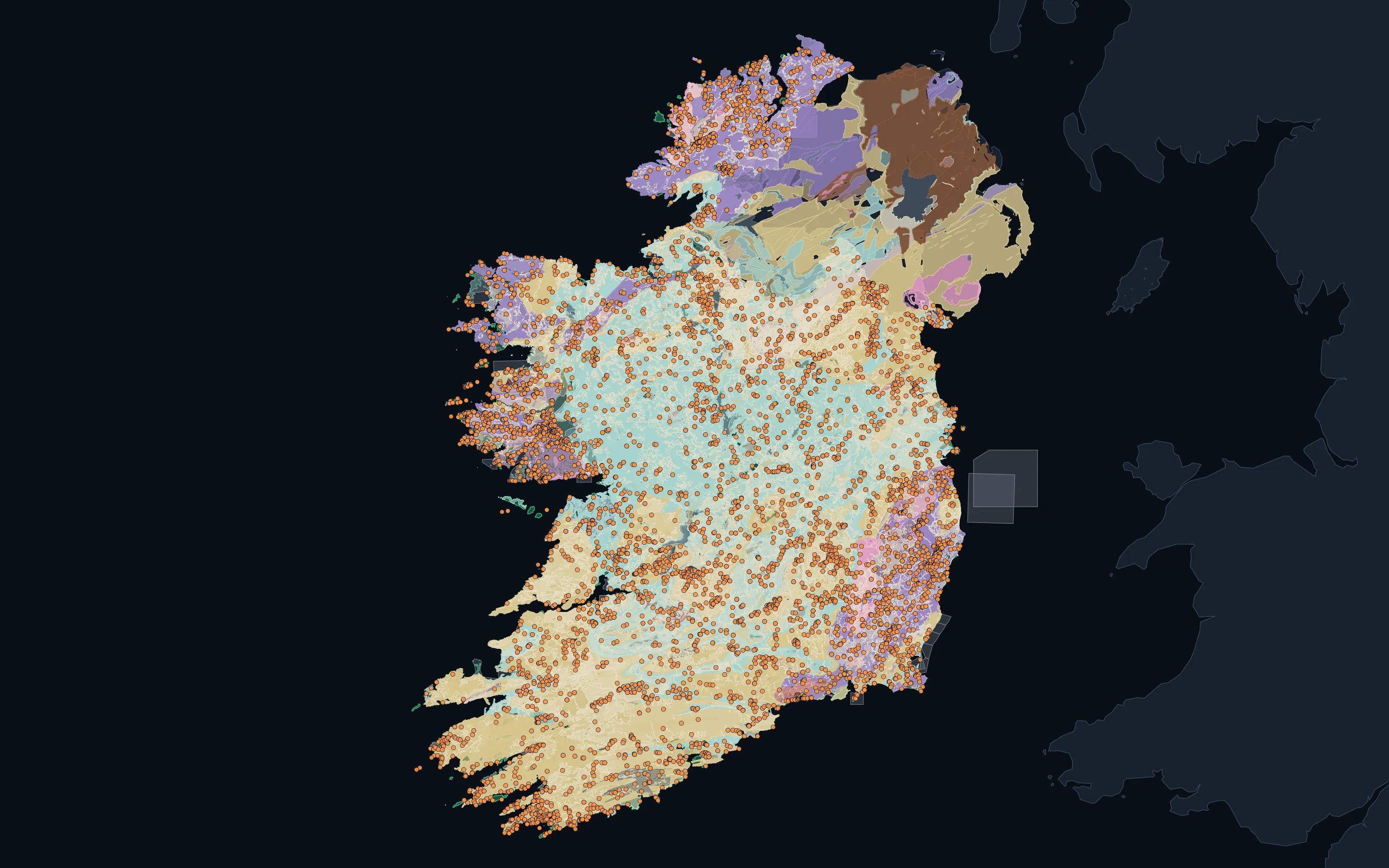
What we hold: 510,000 mapped geological units, 80,000 structural features, 31,000 deposits and occurrences and 3,000 tenure records, from the Geological Survey Ireland and the Geological Survey of Northern Ireland.
Ireland: open ground, mining titles, geology and deposits, as published.
- 514,728
- Geological units
- 80,749
- Structural features
- 31,142
- Deposits and occurrences
- 3,065
- Tenure records
- Live and historic titles
What we hold
The layers for Ireland.
| Layer | Features | Jurisdictions |
|---|---|---|
| Mapped geological unitsLithology and age where the publisher states them | 514,728 | 1 |
| Structural featuresFaults, contacts, lineaments and oriented measurements | 80,749 | 1 |
| Deposits and occurrencesMineral deposits and recorded occurrences | 31,142 | 1 |
| Tenure recordsLive and historic mineral titles from the register | 3,065 | 1 |
| Drillhole collarsWhere the ground has already been drilled | 60,367 | 1 |
| Geochemical sample recordsPublished records; a sample held in two releases or compilations appears twice | 35,538 | · |
Open ground
88%
of 69,000 km² assessed carries no live title. Protected areas are not yet subtracted in every jurisdiction here, so the figure is optimistic. A dated snapshot: a pegging decision needs a live register query on the day.
What we can do here
Five capabilities, in Ireland.
Atlas
Country atlas built, with provenance on every layer.
AvailableOpen Ground
Computed across 1 jurisdiction, optimistic where protected areas are not yet subtracted.
Global modelProspectivity
The global model, for 44 minerals: the map, the geology behind it and a confidence read.
AvailableSpectral
Every satellite acquisition over the ground is searched; hyperspectral where it exists.
On requestDue Diligence
Where the register can be queried live.
The global model in Ireland: 44 minerals
- Antimony
- Barium
- Beryllium
- Bismuth
- Boron
- Caesium
- Chromium
- Cobalt
- Copper
- Dysprosium
- Europium
- Gadolinium
- Gallium
- Germanium
- Gold
- Hafnium
- Indium
- Lanthanum
- Lead, zinc & silver · zinc only
- Lithium
- Neodymium
- Nickel & cobalt · nickel only
- Niobium
- Palladium
- Platinum
- Praseodymium
- Rare earths
- Rubidium
- Samarium
- Scandium
- Selenium
- Silver
- Strontium
- Tantalum
- Tellurium
- Terbium
- Thorium
- Tin
- Tungsten
- Uranium
- Vanadium
- Ytterbium
- Yttrium
- Zirconium
Talk to us
Interested in Ireland?
Talk to us about the record we hold for Ireland, the models, or a partnership.